With many downhill ski resorts in the Northeast expected to be closed or restricted to mitigate the spread of COVID-19, backcountry skiing is booming. In fact, going back to the early spring, outfitters across the region reported shortages of backcountry equipment as skiers skipped the crowded resorts in favor of more remote options. The sport is rigorous, requiring skiers to hike or skin up the mountain before skiing down; knowing where to go can be challenging, too. We’ve rounded up some of the best spots for backcountry skiing, sourced from Best Backcountry Skiing in the Northeast, 2nd ed.—newly released from AMC Books. (AMC’s Winter Recreation Map and Guide is another new resource highlighting local trails for backcountry skiers.) Please note: This list is for the well-practiced. Caution should always be exercised in backcountry skiing, making sure that you dress properly and pack the 10 Essential pieces of gear.

Sargent Mountain, Acadia National Park | Mount Desert, Maine
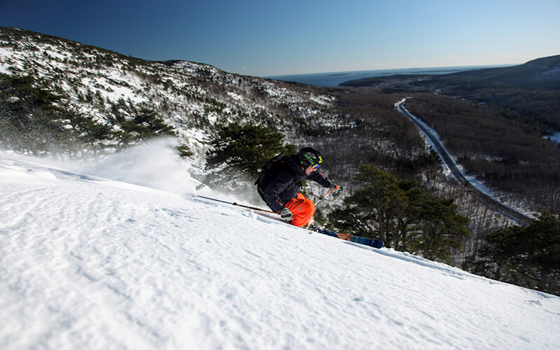
This moderate backcountry route tours Sargent Mountain, opposite to the higher trafficked Cadillac Mountain with stunning and unique views of the Atlantic Ocean. From the Parkman Mountain parking lot (accessed from ME 198, just west of Eagle Lake and a half mile from Upper Hadlock Pond), turn right, and in 100 feet you will reach an intersection with a carriage road. If you’re interested in a direct, 2.8-mile hike to the summit of Sargent Mountain (1,373 feet), turn right onto the Around Mountain Carriage Road, then turn left at Junctions 13 and 12. If you prefer a longer route, take a left and use the Around Mountain Lower Loop. On this route, you’ll ski for 3.2 miles, when you reach Junction 11, turn right, and ascend 200 feet. Take a sharp right at Junction 10 toward the Around Mountain Lower Loop, to ski up the face of Sargent Mountain. You’ll see the Sargent Northwest Trail on the left after 1.7 miles, and from here, the summit is just a 0.7-mile gentle climb along the north face of Sargent Mountain. Ski south along the Maple Spring Trail until you hit Maple Spring, then ski a snowfield on your left. Stay left of Maple Spring Trail on the ridge above a stream after crossing Grandgent Trail, then ski through the trees down to the Hemlock Bridge until you come to the Upper Hadlock Carriage Road Loop. Turn right and return to intersection 12, turn left again, and then right at intersection 13. The Parkman Mountain parking lot will be on your left.
Distance: 5.6 miles from Parkman Mountain parking lot to the Sargent Mountain Summit
Difficulty: Moderate
Info: Best Backcountry Skiing in the Northeast
Zealand Falls Hut Tours, White Mountain National Forest | Jefferson, N.H.
AMC’s Zealand Falls Hut offers a starting point for this tour through the breathtaking Pemigewasset Wilderness, which features ice cliffs, waterfalls, and mountain ponds. Drive east on NH 302 from NH 3. Look for parking after you see signs for the Zealand Campground. There are a few ways to get to the Zealand Falls Hut, the shorter option being to simply ski the Zealand Campground road for 3.2 miles. The Zealand Falls Hut sits at the top of a small hill to the west. You will need to take off your skis and hike the steep final incline to the hut. From there you have several choices for backcountry tours in the area. Skiing through Zealand Notch to Thoreau Falls and Shoal Pond is a beautiful tour full of ecological interest and dramatic views. You can travel on the Ethan Pond Trail—which is part of the Appalachian Trail and on the former Zealand Valley Railroad—to traverse more than 10 miles through Zealand Valley to Shoal Pond. Use caution when skiing across the flank of Whitewall Mountain, which can be icy. When you reach the southern end of Zealand Notch, turn right on Thoreau Falls Trail to reach the falls in 0.2 mile or continue straight to visit Ethan Pond. Note: Zealand Falls Hut is currently closed for overnight and day use due to COVID-19 restrictions.
Distance: 6.9 miles round trip
Difficulty: Moderate
Information: Best Backcountry Skiing in the Northeast
Crescent Ridge Glade | Randolph, N.H.
This 4-mile round-trip route is not for the inexperienced backcountry skier. However, there is no shortage of winter splendor on this route, with its sweeping views of the Presidential Range, including Mount Adams, Mount Madison, and King Ravine. Parking can be found by following US Route 2 West in Randolph, N.H., turning right on Town Hill Road, and then taking a left on Mount Crescent Trail. Ski from the parking lot past the kiosk for the Randolph Community Forest onto a snowmobile trail, which is marked with blue plastic blazes. After 0.25 mile, turn right on Carlton Notch Trail. When Carlton Notch Trail branches to the right in 0.6 mile, keep left to stay on the Crescent Ridge track. You will soon reach a wildlife preserve and a dramatic view of the northern Presidential Range. The trail inclines at a steeper pitch for 0.75 mile before turning right to the North, at which point you will reach the ridge (3,000 feet). The descent takes you through beautiful glades, where you’ll ski your way through twists and turns at a drop of 1,000 vertical feet over 2 miles on your return to the car.
Distance: 4 miles round trip
Difficulty: Challenging
Info: Granite Backcountry Alliance

Greeley Ponds | Lincoln, N.H.
This easygoing trip takes you around the stunning Greeley Ponds, between high rock features and ice cliffs. Parking can be found at the Greeley Ponds trailhead, 4.7 miles east of Lincoln Woods Visitor center on the Kancamagus Highway, and is limited to 10 cars on the south side of the road. Start by following the Greeley Ponds Trail through the trees at a mild incline—it will intersect with the bottom of the ski trail after 1.3 miles at Mad River Notch. Stay on the trail for another 0.3 mile before arriving at Upper Greely Pond, where you can enjoy the open view of the frozen pond through the forest, while high rock outcroppings and ice cliffs drip down from East Osceola. From there, you can choose to ski across the frozen pond if they are sufficiently frozen, or simply trace the hiking route which guides you along the western perimeter at the southern point of the pond. The ski trail marked with blue plastic blazes guides you downhill, and then intersects again with the yellow-blazed hiking trail and drops you off at Lower Greeley Pond. With parking on either end of the route, simply turn back the way you came to return to your car.
Distance: 4.4 miles to Lower Greely Pond, round trip
Difficulty: Moderate
Information: U.S. Forest Service
Jackrabbit Ski Trail | Lake Placid, N.Y.
This route, which takes you on a tour between Lake Placid to Saranac Lake, provides a diverse combination of flat, uphill, and downhill terrain. Start from one of two trailheads, the McKenzie Pond Road trailhead or Lake Place trailhead to access the Jackrabbit ski trail, a segment of a 35-mile hiking and skiing trail system connecting Tupper Lake to Keene. To access the Lake Placid Trailhead from NY 86 (heading west), take a right on Whiteface Inn Lane and drive for 1.3 miles. Opposite the entrance to the Whiteface Club, you will see the red plastic Jackrabbit Trail marker; park outside of the trailheads on either end. From the trailhead on Whiteface Inn Road, ski your way up the gentle incline of the old logging road. In the 1930s, the Civilian Conservation Corps (CCC) transformed this logging road into a fire trail to make it more accessible to firefighters if the need arose. The route continues uphill, meandering over the slope of McKenzie Mountain (3,862 feet). Expect the trail to level out as you reach the birch and spruce-lined plateau. A lean-to marks the trail junction 2.1 miles from Haystack Mountain’s summit. Soon after, you’ll arrive at a trail junction. A sign indicates that you are 2.1 miles from the summit of Haystack Mountain. Either follow this sign toward the Haystack summit (4,961 feet) or stay on the Jackrabbit Trail as it heads back downhill, this is a good spot to reverse if you want to return back to your car.
Distance: 5.5 miles one way from Whiteface Inn to McKenzie Pond Road
Difficulty: Moderate
Information: Barkeater Trails Alliance

Thunderbolt Ski Trail, Mount Greylock | North Adams, Mass.
This former ski racing trail has been restored to its former glory as an acclaimed down-mountain route for backcountry skiers. Drive west up Maple Street from MA 8 in Adams and take a right on Gould Road. Continue straight onto Thiel Road, which terminates with a set of concrete barriers—park here. Past the barriers, a sign for Thunderbolt Ski Trail starts your journey onto the 8-foot-wide foot path. Follow the route over the Hoxie Brook, and at the fork, go right onto the Thunderbolt Trail. Follow this up a steep incline to a 4-way intersection and kiosk. Ascend the Thunderbolt Trail by turning right and onto the Bellows Pipe Trail; bear left at 0.3 mile and head up the mountain. When you connect with the Appalachian Trail, turn left and continue for approximately five minutes until you see the Thunderbolt Ski Trail, from there it’s 0.4 mile to the summit of Mount Greylock (3,491 feet). Before dropping into the Thunderbolt downhill from the summit, stop in at the Thunderbolt Ski Shelter for a rest and a snack. The Thunderbolt is visually striking and requires expert navigation with a 35-degree slope that turns right, even as the slope pitches downward to the left. As the trail narrows, you’ll accelerate as you barrel toward a stretch called the Needle’s Eye. This final segment of the trail is just 15 feet wide and turns swiftly to right. There is a final steep pitch before the finish.
Distance: 6 miles round trip
Difficulty: Challenging
Info: Thunderbolt Ski Runners